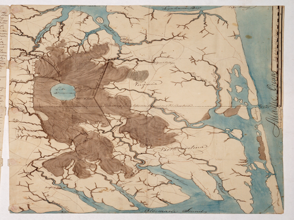
This is a sketch map of the location of the largest Maroon in North America in 1807—The Great Dismal Swamp. At the time I write about, 1791, the swamp was over 2,000 sq. miles–about the size of Delaware. Split between southern Virginia and northern North Carolina, you can see the dotted line dividing those two states.
This area was formed millions of years ago when Africa and North America slammed together, and then eventually split. As long ago as 5,000 years ago, indigenous people resided and hunted here. Before escaping slaves joined them, native people lived on the mesic islands (former sandbars) in the swamp, later called hummocks. Archaeological digs have uncovered the tools, weapons, and projectile points native people employed.
–Around The Late 1600s, the first fugitives from slavery sought sanctuary here.
One interesting point is how that state line was drawn. In 1728, William Byrd II was chartered to survey that line. He quickly gave the swamp its name simply because he thought the whole area rather dismal. Because of the impenetrable conditions he experienced, instead of weeks to survey through the swamp, it took many months. Byrd later wrote about the journey in a report read by many of Virginia’s elite. “[W]e found the ground moist and trembling… foul Damps ascent without ceasing, corrupt the Air, and render it unfit for Respiration.” Some days working through the swamp, Byrd’s team survey progress might be measured in yards.
By the way, Byrd himself never stepped into the swamp. As director of the project, he monitored reports from his field teams that battled the extreme conditions from the comfort of an inn outside the swamp.

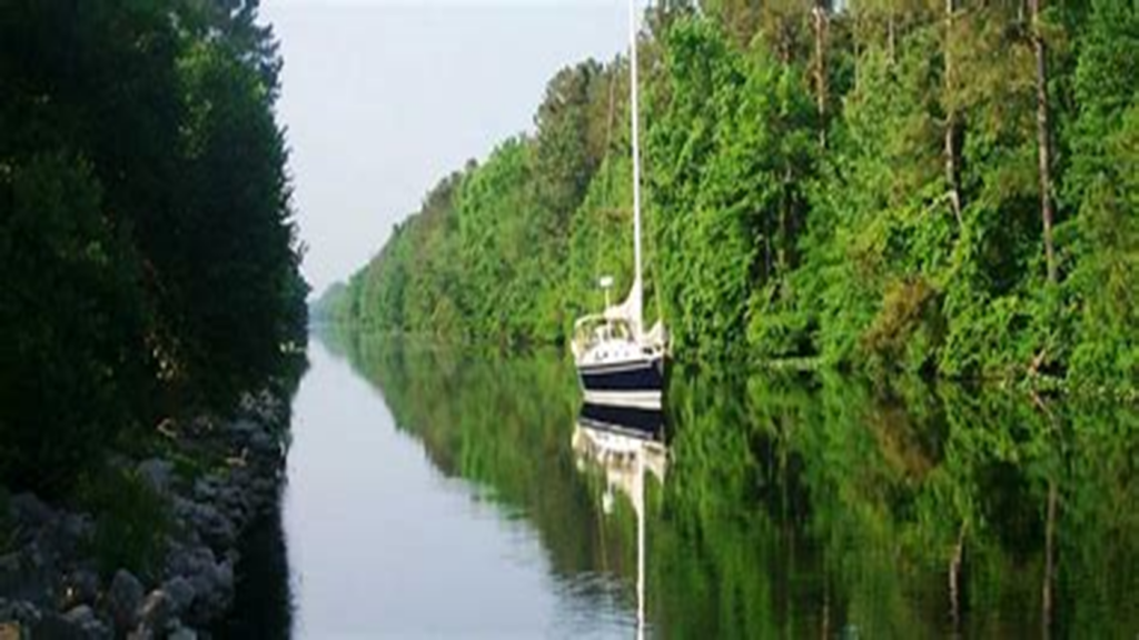
Let’s turn back to The Great Dismal Swamp and what it looks like today.
The footprint of The Great Dismal today is much smaller than its original size, primarily due to commercial interests moving into the swamp and areas on the swamp’s edge being developed. Now composed primarily of a federal refuge managed by the US Fish and Wildlife Agency, state parks also protect some of the swamp and tell the story of the history of the area and its committed residents.
Today, one can take groomed trails or leisurely sail the canal built on the back of exploited labor. Some things haven’t changed since fugitive slaves called this area home. There is still a wide variety of wildlife, and of course, the insects stay just as fierce. The ranger who spent time taking me through the refuge described springtime being especially relentless with mosquitos and biting flies. She explained that when she had to work in the field during those warm months, she often had to don two Tyvek suits and have her face completely covered. Within twenty minutes due to the temperatures and humidity, she was soaked.
With the mission to preserve the wild beauty of the swamp, The Dismal still offers a vibrant variety of nature. People assume that because of the swamp environment, alligators would be a threat. However, the Great Dismal is just far enough north to be too cold for that creature. With Climate Change, there have been sightings of alligators in marshy environments in southern North Carolina. Maybe one day, alligators will reach the Virginia portion of the federal refuge.
–Copperhead snakes are a creature still thriving in the swamp and especially dangerous for humans. Despite the common fear of snakes by many of us, only three of the 27 species of snakes that reside in The Dismal are poisonous. Currently, the swamp is a home and stopover for about 47 species of mammals, 200 types of birds, 96 species of butterflies, and much more. The diverse ecosystem boasts landscapes ranging from bald cypress to red maple and the globally rare Atlantic white cedar. And just like in 1791, Black Bears still rule.